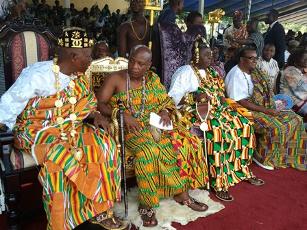
Traditional rulers at Nkonya and Alavanyo in the Volta Region have backed government's plan to take over disputed lands which have been the source of conflict between the two communities for nearly a century. They believe the acquisition of the land by government for training by the security agencies, is a major step in attempts to bring a lasting solution to the conflict between the two communities.
In an interview with JoyFM, chief of Nkonya Nana Apem Darko observed that with security presence on the land, Â safety will be assured for farmers in the area.
He suggested to the regional coordinating council to build a district police station and barracks in the area.
“But at least with there is security zone between the two communities people will confidently farm on other indisputed lands, the regional minister has said it all the only thing I am pleading is such place should be expanded because now that the fight is not on the disputed land but has been spread across the boundaries of the land, if the military takes some part the next extension should be the police..â€
Volta Regional Minister, Archibald Letsa, told parliament on Wednesday the take over move is one of the many steps aimed at bringing about peace to the area.
“We are taking this conflict from many angles and this is just one of several strategies government has decided to take to bring lasting peace to the area.â€
He explained how the decision was arrived at; “During the peace process there have been discussion with the various communities, and we’ve heard people making statement like if the land is the cause of the conflict why won’t government come and take the land and government has also found the place very suitable for jungle walking training for our military and therefore government want to use it for that purpose for the mean time, while we take other measure to bring lasting peace to the area, we are still consulting with the people to the peace process, there was good news last week as the youth of Alavanyo and Nkonya met the regional security council that enough is enough…â€
Â
The conflict between the two communities is caused by a boundary dispute, it is the raising of timber, court verdicts, ethnic politics, and the reinvention of history that constitute the major drivers.
It dates back to 1913 when the area was still under German control. A map was drawn by German Colonial Cartographer, Hans Gruner, in an effort to settle the dispute but it did not work.
The British also took over the land in 1920 and tried to resolve the conflict, but also failed.
These compelled members of Nkonya, who claimed ownership of the land on the basis of first come status, to take the matter to court in 1953.
Court rulings from 1953 to 1980, five in all, have all favoured Nkonya on the basis of the Gruner map but the dispute has persisted.


